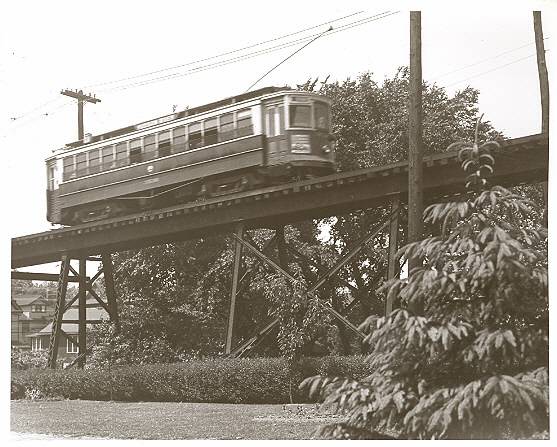
I'm thinking that the trolley is on the Susquehanna Line and the houses are on Banta Place. However, I'm not sure houses were on Banta in 1934, but it is possible.
Trolleys didn't run on railroad tracks.
IF that's the Peoples Trust building, 2 sides of it are visible - split by a tree. Because of the number of windows per floor, the left half is a side wall and the right half is either the front or the rear wall.
If the houses were on Banta place, the right side of the building would be the front, but since the houses' fronts are visible, they are parallel with the front of the building instead of perpendicular, so that rules out Banta Place.
By keeping the right half of the building as the front, a scenario can be created that places the houses on Railroad Ave by Clay St and the trolley on the Erie tracks. The angle fits, but there's one slight problem: as mentioned above, trolleys didn't run on railroad tracks.
So maybe there IS a trolley
yard. It would have to be on Railroad Ave, which pushes the houses back a block to Park. The angle still works, but there's another minor problem: since the trolley's on tracks, those tracks would have to feed from somewhere, but there were no trolley lines running through the Clay St/Railroad Ave area.
So the premise that the front of the bank is visible must be faulty.
Let's say now that it's the back of the building. That places the houses on River St, facing east, just north of Mercer. It also places the trolley right next to the Hudson River Line tracks at a point just after it crosses the Hackensack River and just before it bends to go up Mercer St - a perfect place for a feeder track to a trolley yard.
It works!
On the below trolley map, I used a red arrow to show where the Peoples Trust building is and a green circle to indicate where I think the trolley yard had to be - east of river St and right next to the trolley tracks and Susquehanna RR tracks.